Nº 148 · Catalina Island place
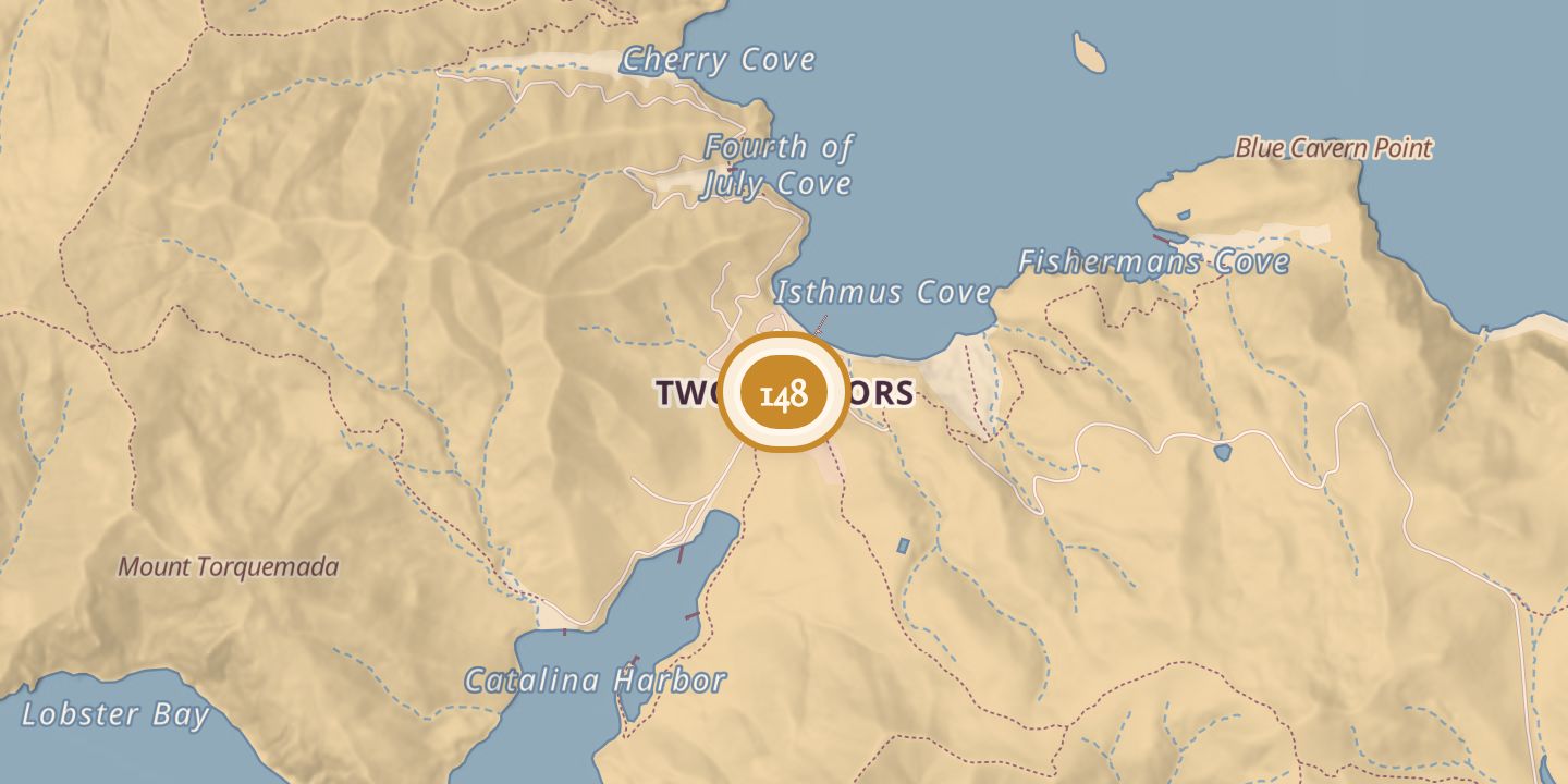
Two Harbors
| First use | The area was known as the Isthmus of Catalina Island; mining for silver, lead, and zinc took place there by the 1860s. |
|---|---|
| Later | Union Army camp; film crews’ barracks; U.S. Coast Guard training base; Isthmus Yacht Club. |
| Today | A village at the isthmus between Isthmus Cove and Catalina Harbor. The former Union barracks is the Isthmus Yacht Club. |
| Location | 33.4400° N · 118.4993° W |
History
The area where Two Harbors stands was originally called the Isthmus of Catalina Island. Mining for silver, lead, and zinc took place there by the 1860s.
In 1864, Union soldiers established Camp Santa Catalina Island and built barracks. Film crews used the barracks in the 1920s and 1930s, and during World War II the area served as the U.S. Coast Guard Catalina Training Base. In 1951, the barracks became the Isthmus Yacht Club.
A Chinese merchant ship, the Ning Po, became a tourist attraction in 1913 and burned off the western shore of the isthmus in 1938; the fire also destroyed several wooden sailing vessels used in films. Two Harbors Elementary School opened in 1987 and closed in 2014. In 2019, astronauts Drew Feustel, Thomas Pesquet, and Norishige Kanai took part in NASA’s NEEMO NXT training in the area.
Chronology
- 1860sMining for silver, lead, and zinc took place in the isthmus area.
- 1864Union soldiers established Camp Santa Catalina Island and built barracks.
- 1913The Ning Po was converted into a tourist attraction.
- 1920s–1930sFilm crews used the Union barracks.
- 1938The Ning Po and several wooden sailing vessels burned off the western shore of the isthmus.
- World War IIThe area served as the U.S. Coast Guard Catalina Training Base.
- 1951The barracks became the home of the Isthmus Yacht Club.
- 1987Two Harbors Elementary School opened.
- 2014Two Harbors Elementary School closed.
- 2019Astronauts Drew Feustel, Thomas Pesquet, and Norishige Kanai trained in the NEEMO NXT mission.
Sources
Every source for this place is numbered on the Sources page, with original records listed first.